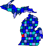

| Size: 564 Square Miles |
| Elevation: 600-900 Feet |
| Physiography: Lake-Border-Plains, Hill-Lands |
| Growing Season: 150-170 days |
| Annual Precipitation: 31-33 inches |
| Average Snowfall: 70-90 inches |
| Forest Type: Maple-Beech, Pine-Aspen, Oak-Hickory |
| Fall Colors: Early October |
| The county was named after the Ottawa Indian tribe. Fur traders were the first settlers. A group of Hollanders from the Netherlands founded Holland. Lumbering and farming were the two major industries. The Grand River was used to ship logs to the sawmills. Riverboats were the main transportation between Grand Haven and Grand Rapids in the beginning, then railroads replaced that in the 1900's. Holland holds the Tulip Festival every year. |
| Agnew | Allendale (49401) | Bauer |
| Beaverdam | Borculo (49464) | Charleston |
| Conklin (49403) | Coopersville (49404) | Crisp |
| Dennison | Drenthe (49464) | Eastmanville |
| Ferrysburg (49409) | Gitchel | Gooding |
| Grand Haven (49417) | Hanley | Harlem |
| Harrisburg | Herrington | Holland |
| Hudsonville (49426) | Jamestown (49427) | Jenison |
| Lamont (49430) | Lisbon | Macatawa (49434) |
| Marne (49435) | Noordeloos | Nunica (49448) |
| Pearline | Pine Creek | Reno |
| Robinson | Snug Harbor | Spoonville |
| Spring Lake (49456) | Tallmadge | Ventura |
| Vriesland | Waverly | West Olive (49460) |
| Wright | Zeeland (49464) | Zutphen |
| Zwemer Beach |
|
Copyright | 2021 | michiganweb.com
|