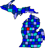

| Size: 581 Square Miles |
| Elevation: 900-1700 Feet |
| Physiography: Upland plains, Hill uplands |
| Growing Season: 100-130 days |
| Annual Precipitation: 29-33 inches |
| Average Snowfall: 50-70 inches |
| Forest Type: Maple-Beech-Hemlock, Pine-Oak, Aspen-Birch |
| Fall Colors: Early October |
| The county was first named "Unwattin" after an Ottawa Indian Chief but was later changed to Osceola after an Indian Chief from Florida. The first white settler was Nathan Hersey, a fur trapper. Delos A Blodgett, a lumber baron, who planted the county's first crop of potatoes. For awhile lumbering was Osceola's main industry. Today Osceola is a leading Oil and Gas industry and there is still some farming. |
| Ashton | Avondale | Brookside |
| Chippewa | Crapo | Dighton |
| Evart (49631) | Gormer | Hersey (49639) |
| Highland | Ina | Leroy (49655) |
| Marion (49665) | Reed City (49677) | Sears (49679) |
| Tustin (49688) |
|
Copyright | 2021 | michiganweb.com
|