
| Size: 565 Square Miles |
| Elevation: 1000-1300 Feet |
| Physiography: Hilly Uplands |
| Growing Season: 90-110 days |
| Annual Precipitation: 29-33 inches |
| Average Snowfall: 60-80 inches |
| Forest Type: Aspen-Birch, Maple-Beech-Hemlock, Pine-Oak |
| Fall Colors: Late September - Early October |
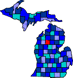
| Missaukee County was named after an Ottawa Indian Chief who was known as "Neasaukee", which means "Large mouth of river". After the Civil War loggers and Union veterans settled here. In 1895 most of Missaukee County was destroyed by forest fires including some of Michigan's oldest White Pine timber. Today the county is a year-round vacation area. The main industry is dairy farming and best know for its Christmas Trees. |
| Arlene | Butterfield | Cutcheon |
| Dinca | Dolph | Falmouth (49632) |
| Jennings | Lake City (49651) | Lucas |
| McBain (49657) | Merritt (49667) | Moddersville |
| Moorestown (49651) | Morey | Pioneer |
| Prosper | Stittsville |
|
Copyright | 2021 | michiganweb.com
|