Michiganweb - Michigan Info Net

MECOSTA COUNTY MICHIGAN


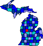
Mecosta county map

Size: 563 Square Miles
Elevation: 800-1100 Feet
Physiography: Rolling plains, Hilly uplands
Growing Season: 120-150 days
Annual Precipitation: 30-32 inches
Average Snowfall: 50-70 inches
Forest Type: Maple-Beech-Birch-Hemlock, Oak-Hickory
Fall Colors: Early October

Mecosta county was named after a Potawatomi chief meaning "bear cub" By 1850 there was settlements and a sawmill constructed. It took the railroads to get more settlers to the area. By 1884 there were 21 sawmills. The Muskegon River helped with lumbering. Gradually agriculture began to become the major industry. Today there is still some farming and manufacturing. Mecosta is a resort area. Mecosta County was home to one of Michigan's former governors, Woodbridge N. Ferris. He started the Ferris Industrial School, today know as Ferris State University. The County offers parks, and Rails-to-Trails for hiking, boating, canoeing, water skiing and fishing.

Mecosta County Area Chamber of Commerce

Mecosta County Government Page

Mecosta County Development Corporation

Altona Barryton (49305) Big Rapids (49307)
Borland Byers Chippewa Lake (49320)
Crapo Fork Mecosta (49332)
Millbrook (49310) Morley (49336) Paris (49338)
Pogy Remus (49340) Rienzi
Rodney (49342) Rustford Stanwood (49346)
Sylvester Titus blank


Main Page Disclaimer

Copyright | 2021 | michiganweb.com