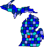

| Size: 575 Square Miles |
| Elevation: 700-900 Feet |
| Physiography: Rolling Plains |
| Growing Season: 110-130 days |
| Annual Precipitation: 30-32 inches |
| Average Snowfall: 40-60 inches |
| Forest Type: Maple-Beech, Oak-Hickory |
| Fall Colors: Early October |
| Villages of Potawatomi, Ottawa and Chippewa are along the Grand River. In 1832 Samuel Dexter settled along the River along with other pioneers what is now known as Ionia city. A farming county, where wheat was exported on the Grand River. In the mid 1880's the Belding brothers built a silk mill in the city of Belding. The mills closed in 1932 but some of the buildings are still there. Ionia economy ranges from auto parts manufacturing to social services to agriculture. Considered one of the largest fairs in the mid-western United States is the Ionia County Free Fair which is every summer in Ionia. |
| Belding (48809) | Clarksville (48815) | Collins |
| Elmdale | Hubbardston (48845) | Ionia (48846) |
| Lake Odessa (48849) | Lyons (48851) | Matherton |
| Muir (48860) | Orleans (48865) | Palo (48870) |
| Pewamo (48873) | Portland (48875) | Prairie |
| Saranac (48881) | Sebewa | Shiloh |
| Smyrna (48887) | Tremaine |
|
Copyright | 2021 | michiganweb.com
|