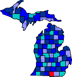

| Size: 600 Square Miles |
| Elevation: 900-1200 Feet |
| Physiography: Rolling plains, hilly uplands |
| Growing Season: 140-160 days |
| Annual Precipitation: 33-36 inches |
| Average Snowfall: 40-60 inches |
| Forest Type: Maple-Beech, Oak-Hickory |
| Fall Colors: Middle October |
| Hillsdale county was given its name because of the rolling green hills an valleys. It is also the only county that borders two other states, Indiana and Ohio. The first white settler came in 1827. Others followed and many were New Englanders. Villages began to grow where the travelers stopped to rest. These were Somerset, Moscow, Jonesville and Allen's Corner. Hillsdale is the oldest major city in mid-Michigan. In 1871 the railroad made it an important rail center. The Baptist Hillsdale College opened in 1844. Hillsdale county was a major farming area. Today Hillsdale County has manufacturing, outdoor recreational opportunities, with over a hundred inland lakes. |
| Allen (49227) | Austin | Bankers |
| Betzer | Cambria | Camden (49232) |
| Frontier (49239) | Hillsdale (49242) | Hoxie |
| Jefferson | Jerome (49249) | Jonesville (49250) |
| Litchfield (49252) | Mallory | Milnes |
| Moderville | Montgomery (49255) | Moscow (49257) |
| Mosherville (49258) | North Adams (49262) | Omega |
| Osseo (49266) | Pittsford (49271) | Prattville (49271) |
| Ransom | Reading (49274) | Saratoga |
| Shadyside | Somerset (49281) | Somerset Center (49282) |
| Steamburg | Waldron (49288) | Wheatland |
| Woodbridge |
|
Copyright | 2021 | michiganweb.com
|