
| Size: 757 Square Miles |
| Elevation: 900-1500 Feet |
| Physiography: Hill-lands |
| Growing Season: 90-130 days |
| Annual Precipitation: 30-33 inches |
| Average Snowfall: 60-110 inches |
| Forest Type: Maple-Hemlock, Aspen-Birch, Spruce-Fir |
| Fall Colors: Late September |
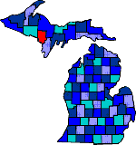
| Dickinson County was named for Donald M Dickinson who was Postmaster General under President Grover Cleveland. Iron was first found in the late 1840's. The Chapman Mine became one of the largest iron ore producers during the period from 1880 until it closed in 1934. Today Dickinson still has some iron ore mining and lumbering. Pine Mountain Ski Slide is here. |
| Channing (49815) | Felch (49831) | Foster City (49834) |
| Hardwood (49807) | Iron Mountain (49801) | Kingsford (49802) |
| Loretto (49852) | Norway (49870) | Quinnesec (49876) |
| Ralph (49877) | Sagola (49881) | Vulcan (49892) |
|
Copyright | 2021 | michiganweb.com
|