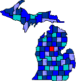

| Size: 571 Square Miles |
| Elevation: 800-1300 Feet |
| Physiography: Hill-lands; Upland Plains |
| Growing Season:90-130 days |
| Annual Precipitation:29-31 inches |
| Average Snowfall: 40-60 inches |
| Forest Type:Aspen-Birch, Maple Beech, Oak-Hickory |
| Fall Colors:Late September to early October |
| The county was first named Kaykee after a Chippewa chief in 1840. An Irish surveyor in 1843 change the name in honor of the county of his origin. The first family to settle in Clare county was William Crawford, a Civil War veteran, in Grant Township. It was here a sawmill was built and a village soon grew, and later became known as Dover. Lumbering was a major industry. With the automobile in the 1920's, tourist and sportsmen came to the area because of the many lakes and streams. Besides its recreational attractions, Clare County sustains farming and some small scale manufacturing. |
| Airport Forest | Allendale (49401) | Ash Acres |
| Browns Corners | Buck Trails | Clare (48617) |
| Colonville | Cooperton | Dover |
| Elm Grove | Farwell (48622) | Harrison (48625) |
| Hatton | Hubbels | Lake (48632) |
| Lake George (48633) | Leota | Long Lake Heights |
| Meredith | Phelps | Piney Woods |
| Rainbow Bend | Renrick | Sheldons Crossing |
| Temple |
|
Copyright | 2021 | michiganweb.com
|